Pontesford Llanymynech Pandy Outcrop Trevor Area
Dinbren Monk's Buttress
Pinfold Twilight Area
Craig Arthur
World's End Minera Quarry Pot Hole Quarry Maeshafn Devil's Gorge Ruthin Area
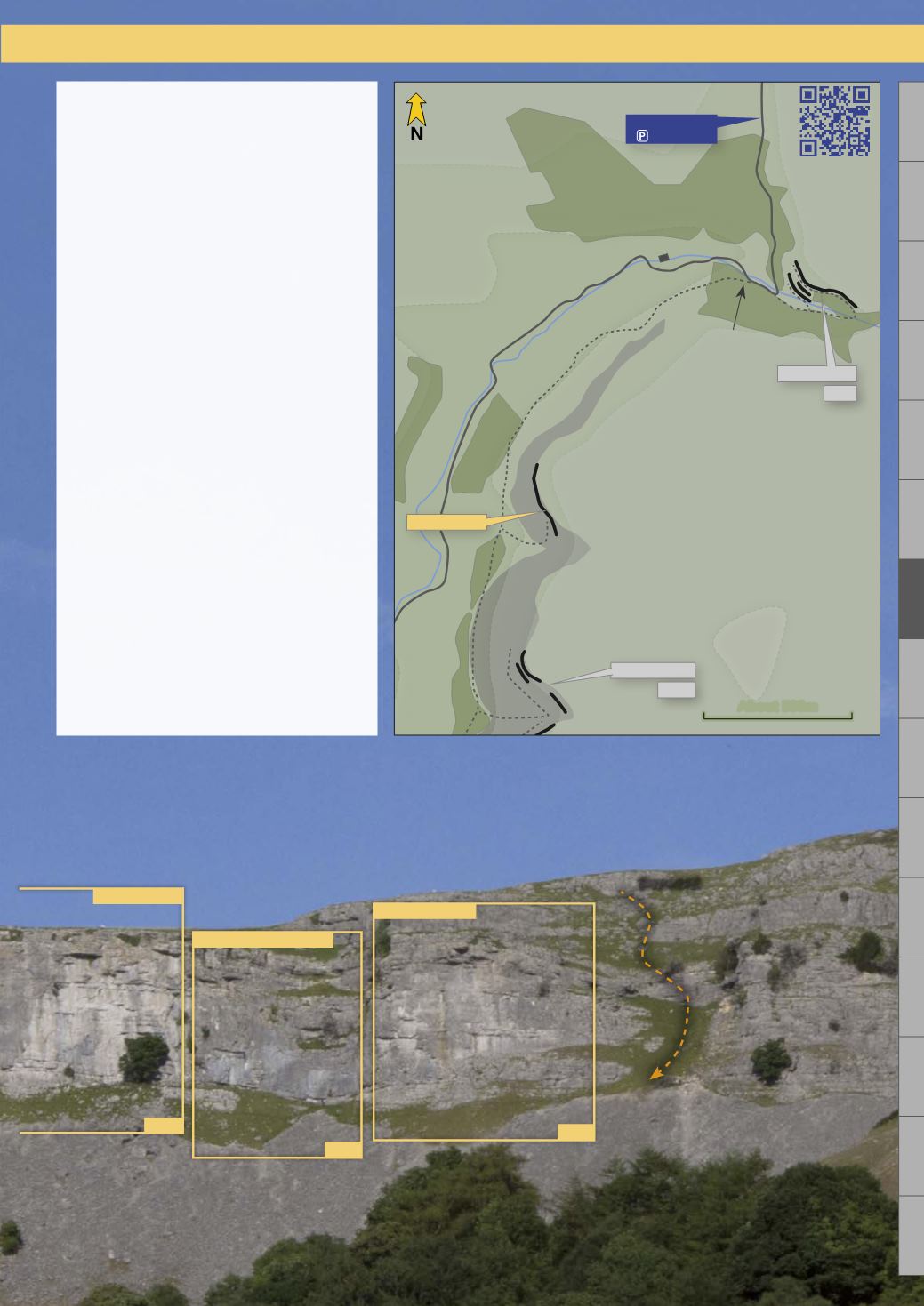
Approach
See map on page 81
From Llangollen, follow the road
to the junction at 1.8 miles and
continue up the narrow valley
road for 2.9 miles, passing under
many of the Eglwyseg crags, until
the road bends rightward and
starts to climb. Continue up the
road until a ford on a sharp bend
is crossed, 400m further on just
as the road exits the woods onto
the moor park on the roadside.
Walk back down the road to the
ford and continue for 30m until
the Offa's Dyke foothpath on
the left can be taken. Follow the
path for 1.2km, until the stark
profile of Craig Arthur is visible
high on the left skyline. An old
path leads diagonally up the
steep scree slope to the base of
the crag at the Le Chacal Area.
For environmental reasons (the
preservation of the scree slope),
please walk a further 300m along
the path and approach the base of
the crag up a shallow grass gully.
97
Craig Arthur
Nemesis Wall
p.108
Rubberbandman Area
p.112
Sunnyside Area
p.114
Descent
About 500m
Twilight Area
p.116
Craig Arthur
Signed
'Offa's Dyke'
GPS
53.027707
-3.145946
World's End
p.82
scan for
map


