A couple of sign changes and some development work have made the approach descriptions out-of-date in the 2013 edition of Spain : Costa Blanca
Sax (Cabreras)
The signs to ‘El Plano’ (or ‘La Plano’) have disappeared making it awkward to get through the town. A new description and map below. The last section appears to be much the same as it was when we wrote the guide but it may change in light of the various developments.
New Approach Description
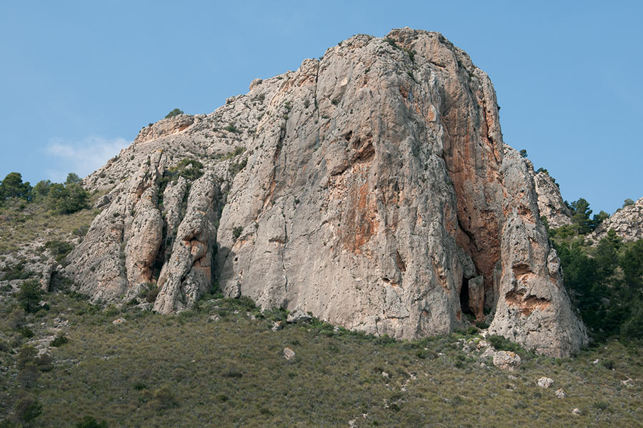
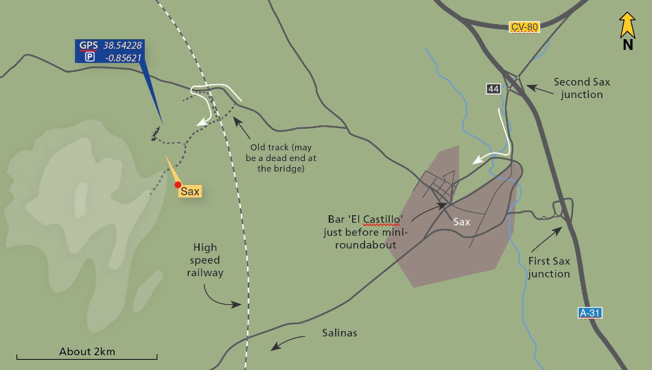
Drive from Alicante towards Madrid on the A31 and take the second turn off to Sax (junction 44). Drive towards the town, cross the river then turn right and follow the road as it loops round the town passing below the castle walls. Initially follow a sign for ‘El Plano’ as you re-enter the town then turn right by Bar Castillo, just before a mini-roundabout. Follow this road straight out of town for around 1km then fork left (not towards ‘El Plano’) – still on tarmac. After around 1.5km cross the high-speed rail-link (being constructed so this may change). Double-back left onto a track after crossing the railway. Follow this next to the railway for 200m and another bridge on the left (it may be possible to come direct to this point over this bridge). Turn right towards the Peñas del Rey, which is now clearly visible on the hillside. Branch right (sandy) to reach a parking spot directly below the crag.
Salinas
A crucial sign has changed on the approach. Where the text says ‘Finca Castillejos’, the sign actually now says ‘Las Fontanas’.
Thanks to Martin Kocsis for this information.
