Route Symbols
1
A good route which is well worth the effort.
2
A very good route, one of the best on the crag.
3
A brilliant route, one of the best in the Clwyd area.
4
A significant route which is one of the best of its
type and grade in the book.
t
Technical climbing requiring good balance and
technique, or complex and tricky moves.
p
Powerful climbing; roofs, steep rock, low lock-
offs or long moves off small holds.
s
Sustained climbing; either lots of hard moves or
steep rock giving pumpy climbing.
f
Fingery climbing with significant small holds on
the hard sections.
h
Fluttery climbing with big fall potential and scary
run-outs.
r
A long reach is helpful, or even essential, for one
or more of the moves.
l
Some loose rock may be encountered.
Crag Symbols
S
Angle of the approach walk to the crag with
approximate time.
E
Approximate time that the crag is in the direct sun
(when it is shining).
$
The crag is exposed to bad weather and will catch
the wind if it is blowing.
*
The crag can offer shelter from cold winds and it
may be a good suntrap in colder weather.
@
The crag suffers from seepage. It may well be wet
and unclimbable in winter and early spring.
!
The crag is steep and may well offer some dry
rock to climb when it is raining.
C
Some or all of the routes have a restriction due to
nesting birds. Details in the crag information.
X
Some or all of the routes are affected by an access
problem. Details in the crag information.
Deserted -
Currently under-used and usually quiet.
Fewer good routes or remote and smaller areas.
Quiet -
Less popular sections on major crags,
or good buttresses with awkward approaches.
Busy -
Places you will seldom be alone, especially
at weekends. Good routes and easy access.
Crowded -
The most popular sections of the most
popular crags which are always busy.
Pontesford Llanymynech Pandy Outcrop Trevor Area
Dinbren Monk's Buttress
Pinfold Twilight Area Craig Arthur
World's End Minera Quarry Pot Hole Quarry Maeshafn Devil's Gorge Ruthin Area
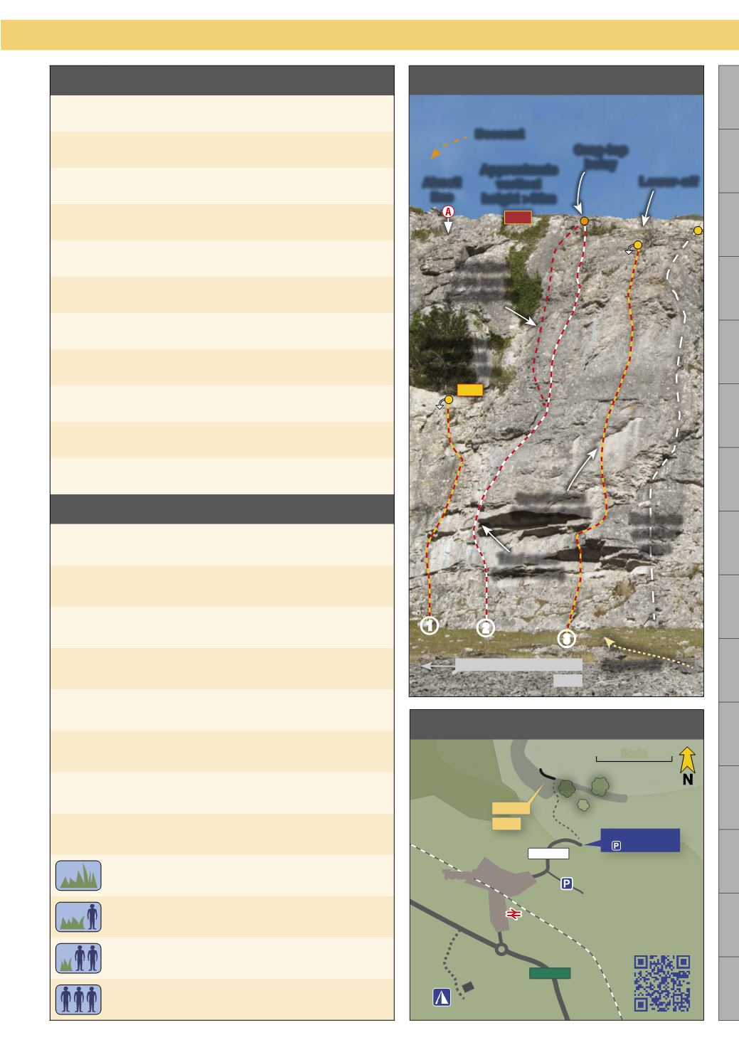
Map Key
Campsite
Train
station
QR code for
smartphone
navigation
Town/village
Woods
Trees
Scree
Scale
A Roads
B Roads
GPS
Coordinates
of parking
A Crag
page
Additional
parking
Building
scan for
map
9
Symbol, Map and Topo Key
Clwyd Limestone
1
2
3
Variation
(see route
description)
Crag-top
belay
Lower-off
Abseil
line
Descent
Topo Key
Sport route
(yellow dash)
Trad route
(white dash)
Approach
Route on
another
page
Approximate
vertical
height >30m
Approximate
vertical
height <30m
20m
Buttress on another page
page
35m
14 min


