Route Symbols
1
A good route which is well worth the effort.
2
A very good route, one of the best on the crag.
3
A brilliant route, one of the best on Eastern Grit.
4
A significant route which is one of the most iconic of
its type in the book.
t
Technical climbing requiring good balance and
technique, or complex and tricky moves.
p
Powerful climbing; roofs, steep rock, low lock-offs or
long moves off small holds.
s
Sustained climbing; either lots of hard moves or steep
rock giving pumpy climbing.
f
Fingery climbing with significant small holds on the
hard sections.
h
Fluttery climbing with big fall potential and scary
run-outs.
r
A long reach is helpful, or even essential, for one or
more of the moves.
k
Graunchy climbing, wide cracks or awkward thrutchy
moves.
l
Some loose rock may be encountered.
g
Typical rounded gritstone holds and sloping breaks.
o
A dynamic move ('dyno') may be required.
w
A sit-down start for a boulder problem.
Crag Symbols
S
Angle of the approach walk to the crag with
approximate time.
E
Approximate time that the crag is in the direct sun
(when it is shining).
$
The crag is exposed to bad weather and will catch the
wind if it is blowing.
*
The crag can offer shelter from cold winds and it may
be a good suntrap in colder weather.
@
The crag suffers from seepage. It may well be wet and
unclimbable in winter and early spring.
&
The rock can be green and dirty after prolonged rain.
Deserted -
Currently under-used and usually quiet.
Fewer good routes or remote and smaller areas.
Quiet -
Less popular sections on major crags,
or good buttresses with awkward approaches.
Busy -
Places you will seldom be alone, especially at
weekends. Good routes and easy access.
Crowded -
The most popular sections of the most
popular crags which are always busy.
Southern Crags
Chatsworth Area
Derwent Edges
Millstone Area
BurbageValley
Stanage
Ladybower Area
Sheffield Area
7
6
9 8
0
q
9
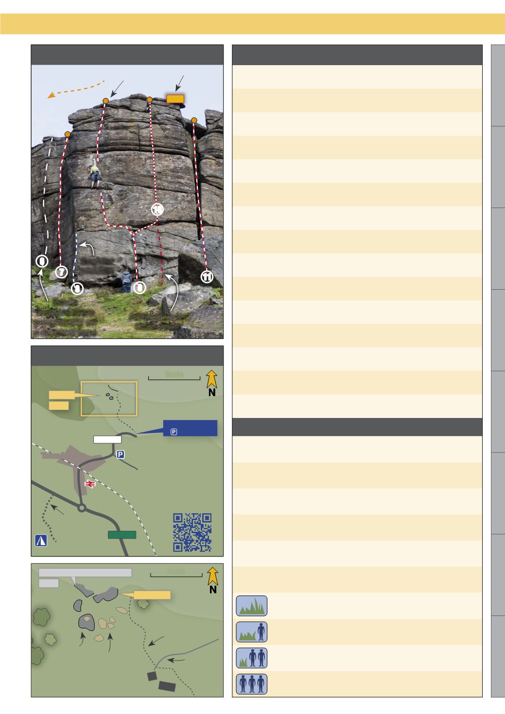
Introduction
Eastern Grit
20 mins
Descent
Belay
Height
indicator
Route
featured more
prominently on
a different topo
Boulder
problem
Alternative for
same route
Campsite
Buildings
Minor unclimbed
boulders
Boulder
Train
station
QR code for
smartphone
navigation
Town/village
Footpath
Trees
Additional
parking
Scale
Scale
A Roads
B Roads
GPS
Coordinates
of parking
A buttress on another page
page
Track
Wall
Topo Key
Map Key
A crag
page
A buttress
16m
scan for
map


