UKC

NEWS: Place Nicknames Added to Tool to Aid Emergency Services

New Topic
Please Register as a New User in order to reply to this topic.
 UKC/UKH News 08 May 2024

Ordnance Survey is inviting emergency service organisations around Great Britain to input local and colloquial nicknames to a new database called the Vernacular Names Tool, as an aid to getting responders to the right location even if accurate coordinates aren't immediately available. 

Read more

 gld73 08 May 2024
In reply to UKC/UKH News:

That could be really useful. 999 call takers can be anywhere in the country and so won't necessarily know the local geography and place names when someone calls, and ambulance crews (for example) might be from outside the area and not know local place nicknames, so just be heading to wherever their mapping plots to if they're allocated the job. 

Nothing has come out to ambulance crews in my area asking for local input, so I'll forward the info on to see if it can be put in the monthly newsletter or something; I can already think of a couple of obvious spots I'll suggest.

In reply to UKC/UKH News:

Maybe they could get emergency services to be able to use OSGB coordinates first....

Post edited at 17:45
 minimike 08 May 2024
In reply to captain paranoia:

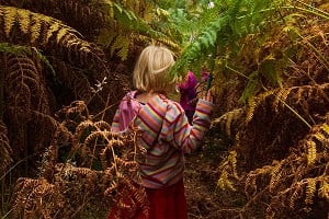
Geoguesser.. where’s the photo?

 Snyggapa 08 May 2024
In reply to UKC/UKH News:

Is this database available to the public as I am sure some suggestions could be made if so, such as outcrop names , i.e. baggy point has long rock, the promontory, scratching zawn etc

In reply to minimike:

Huh?

 deepsoup 08 May 2024
In reply to minimike:

> Geoguesser.. where’s the photo?

Spoiler alert: if you read the article the photo has a caption on it saying exactly where it is.

3
 ROFFER 09 May 2024
In reply to deepsoup:

> Spoiler alert: if you read the article the photo has a caption on it saying exactly where it is.

Only the one with the climbers.

My guess is Heddon's Mouth, on the Exmoor Coast Traverse for the headline picture.

In reply to ROFFER:

It's got a caption if viewed on a computer, but not on a phone (slightly reduced layout for phone scrolling).

And you're bang on - it's Heddon's Mouth heading for The Claw (big feature, not named on standard maps)

1
 Fiona Reid 13 May 2024
In reply to UKC/UKH News:

Interesting.

I wonder if they've considered that "The Ben" doesn't always refer to the mountain above Fort William? 

Round where I live it quite often refers to Ben Wyvis and further east to Ben Rinnes. 

In reply to UKC/UKH News:

I have to find places regularly as part of my job, my customers and I use ‘what3words’. Each square meter of the world is divided up and given a 3 word reference. Their app has a built in navigation tool. Pin point accuracy for a helicopter but obviously phone signal dependant if the 3 words isn’t already known by the party in need of rescue.

6
 Toerag 09:34 Thu
In reply to Davecapewell:

w3w has issues, look up previous threads.

 StuDoig 09:44 Thu
In reply to Davecapewell:

There are a lot of practical problems with using w3w for rescues - a fair number of threads that detail them.  MREW and SMR have both put out statements regarding them previously. 

Reply to thread.

Using local names is a great addition - one we tout a lot to new recruits to our teamas so many commonly used names aren't on a map.  Even those well known to walkers e.g. fairy Glen by being a bhuird aren't on maps and won't be known to remote control rooms.

Better would be getting the control rooms to accept grid refs first though!

In reply to Davecapewell:

W3W have a great marketing department.
OS dont!


New Topic
Please Register as a New User in order to reply to this topic.
Loading Notifications...